Wind and Snow in the Forecast
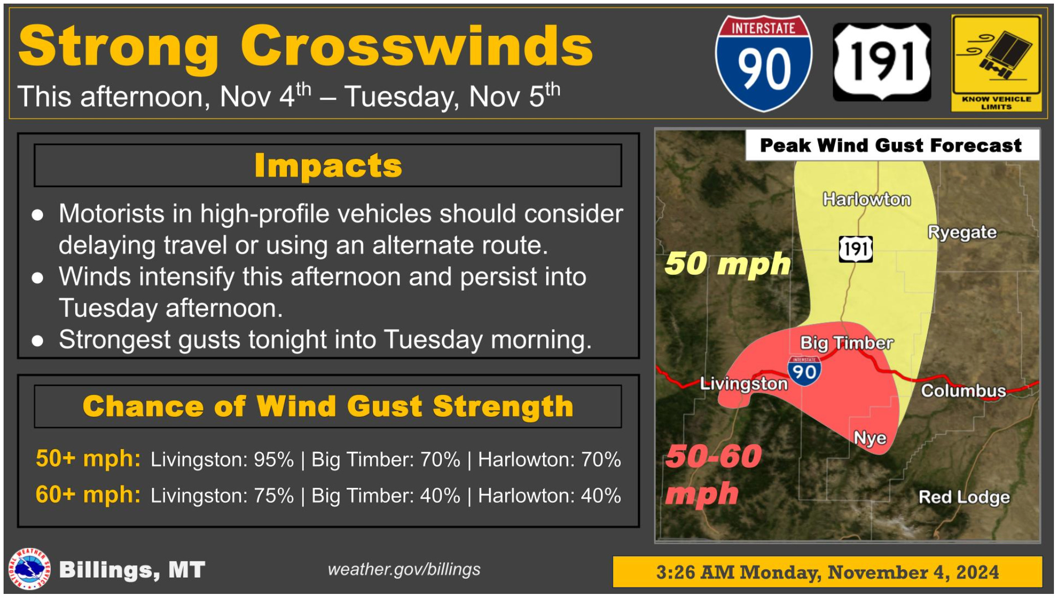
Main impacts for the next few days are strong gusts in the western foothills and the first snow, light though it may be, for most of the area
From National Weather Service bulletins
The Billings office of the National Weather Service is forecasting strong wind gusts for the upper Yellowstone and Stillwater river valleys today, expanding into the US191 corridor (Big Timber to Harlowton) tonight into Tuesday morning ahead of a Tuesday morning cold front. Gusts around 60 mph are expected from Livingston to Nye, with gusts around 50 mph for the US-191 corridor. As the cold front arrives Tuesday morning, snow chances will increase over the higher terrain. By afternoon snow chances pick up for the western valleys and foothills.
Tuesday night, snow levels drop to around 2,000 feet bringing the first chance for lower elevation snowfall to most of the forecast area this Fall. At this time, snow accumulations are forecast to be light enough to not require winter advisories or warnings. However, the latest model guidance is hinting at a chance for heavier snowfall over area mountains, as well as in areas southeast of Billings across the Crow Reservation and into the Wolf Mountains. They will be keeping a close eye on this situation and will adjust accordingly should those higher amounts become more certain.
The main impacts for the next few days are the strong gusts in the western foothills, and the first snow, light though it may be, for most of the area.


