


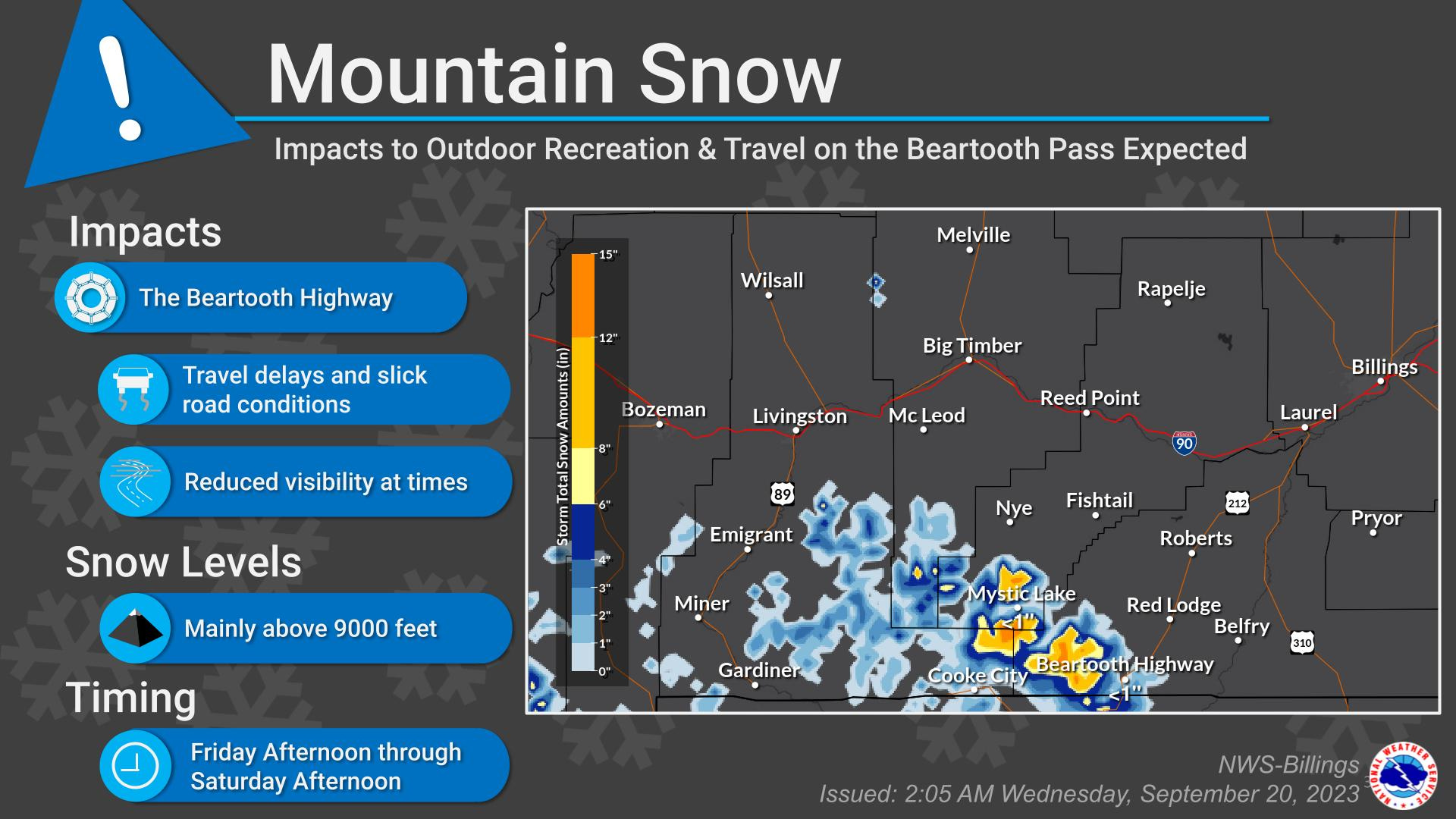
Changing weather including heavy, widespread rain will impact our area beginning Thursday and continuing through Sunday. Mountain snow is expected to occur Friday afternoon through Saturday morning in the Beartooth Mountains and Bighorns. The National Weather Service reports very high confidence (above 80% chance) that there will be at least half an inch of rain over a three day period and high confidence (above 50% chance) of getting an inch of rain. Much higher amounts of rain are possible in localized areas where small storms or showers occur. Possible impacts include ponding water and minor flooding. Expect rapid reductions in visibility under heavy rain showers and storms.
On Thursday, heavy rain, small hail, and gusty winds are all possible threats. On Friday, heavy rain is the main threat with the other factors becoming a lower risk. Snow will occur at elevations above 9000ft Thursday through Saturday, with the heaviest snow expected Friday afternoon through Saturday afternoon.
The Beartooth Highway is expected to be impacted with slick, snow covered surfaces and reduced visibility, especially at its higher locations around Vista Point Friday afternoon through Saturday. Always take care, be aware and be prepared for changing conditions when driving, working or recreating in Carbon County.