


Warm and Dry Today, Then Multiple Rounds of Precipitation Tonight Into the Weekend

From the Billings office of the National Weather Service
KEY POINTS
Warm and dry today, then scattered showers tonight into Tuesday morning
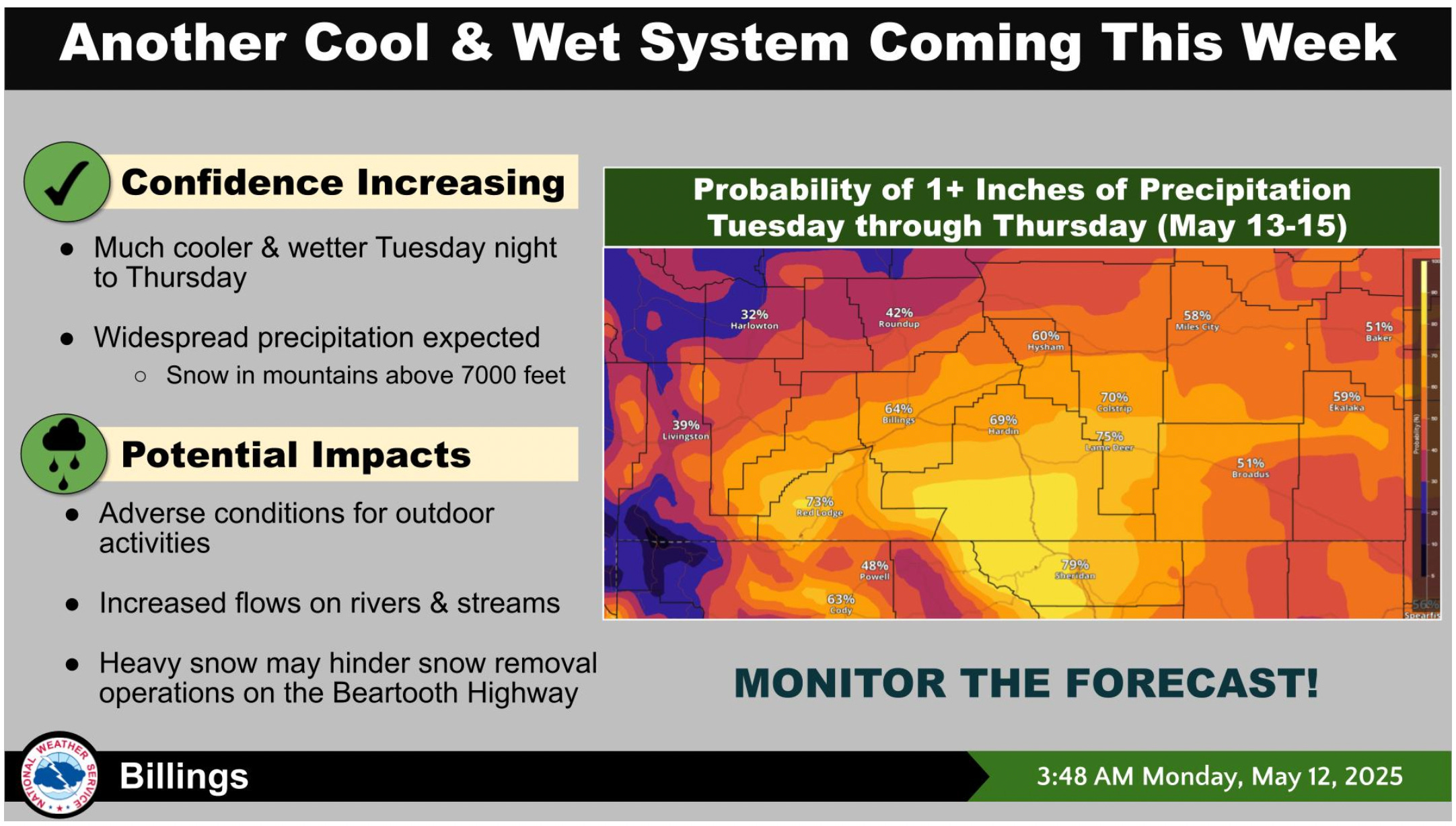
Potential for significant widespread precipitation Tuesday afternoon to Thursday
Streams and rivers are running higher
Additional precipitation Friday into the weekend

DETAILS
Warm and dry today, then scattered showers tonight into Tuesday morning
More snow melt in the mountains.
Breezy in the western foothills today with gusts to 35-45 mph.
Cold front arrives tonight with winds gusting to 30 mph for a few hours.
A few locations could gust to 40-50 mph tonight.
Scattered showers tonight into Tuesday morning will drop less than 0.10 inch of precipitation.
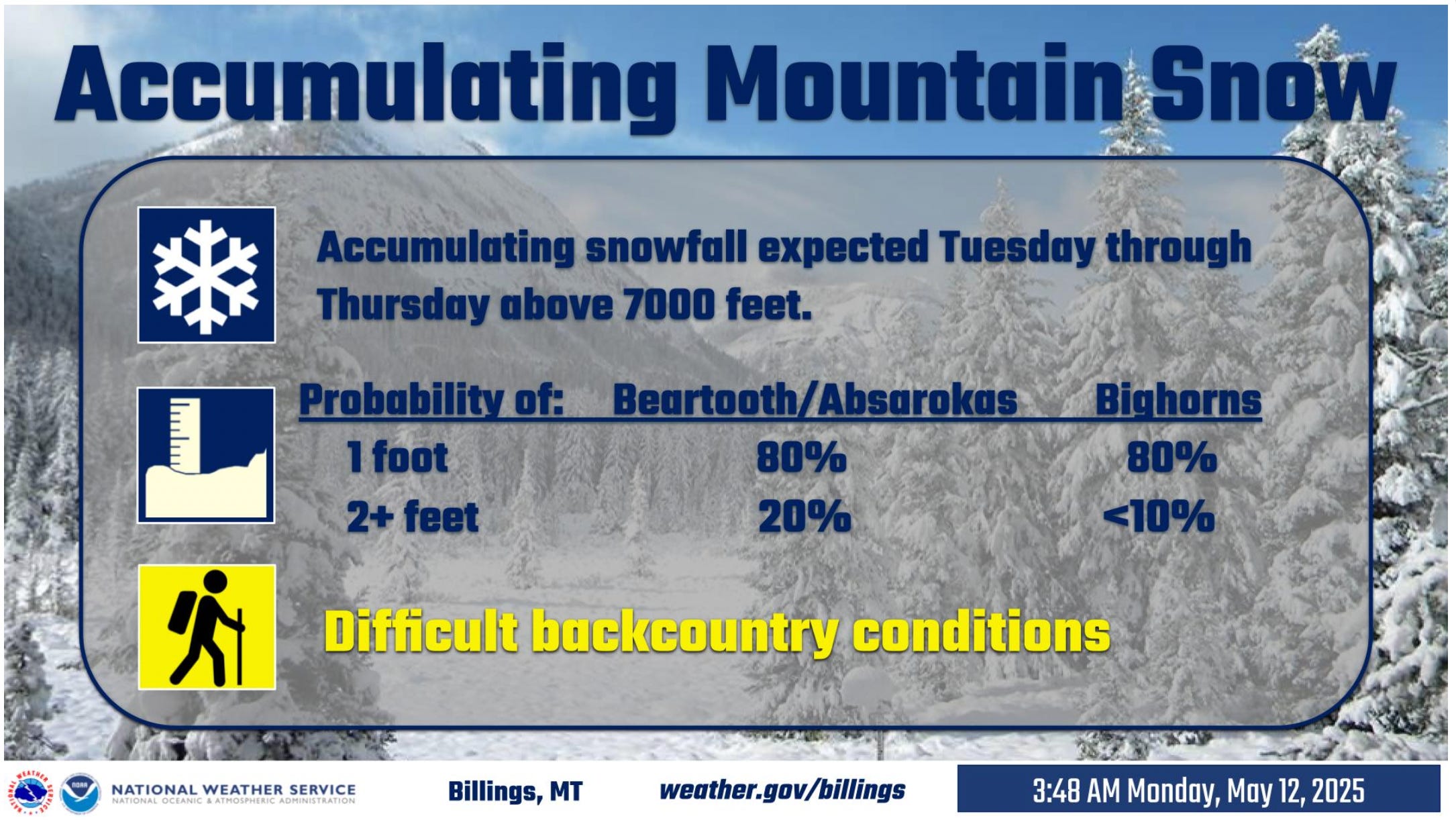
Potential for significant widespread precipitation Tuesday afternoon to Thursday
Precipitation will expand from west to east Tuesday afternoon into the evening.
30 to 90% chance of precipitation greater than 1 inch.
Snow will fall above 7000 feet.
Beartooth Pass will be impacted by snow.
Streams and rivers are running higher than they were about one week ago
Minor flooding is possible on some smaller streams near the foothills from the mountain snow melt and rain expected to fall in the lower elevations.
Those with interests along these areas should take the necessary precautions at this time.
Flooding is not anticipated on larger rivers and streams.

Additional precipitation Friday into the weekend
Showers Friday and Saturday will produce less than 0.5 inch of precipitation per day.
Potential for heavier precipitation on Sunday, with a 20-50% chance of receiving another 1 inch of precipitation in south central Montana and north central Wyoming.
Precipitation will fall as rain in the lower elevations and snow in the mountains.
90% chance that the snow level will be between 6000 and 9000 feet.
FOR MORE INFORMATION
For the latest forecast updates, visit weather.gov/billings.