


Update on Severe Storms Possible Friday

From the Billings Office of the National Weather System
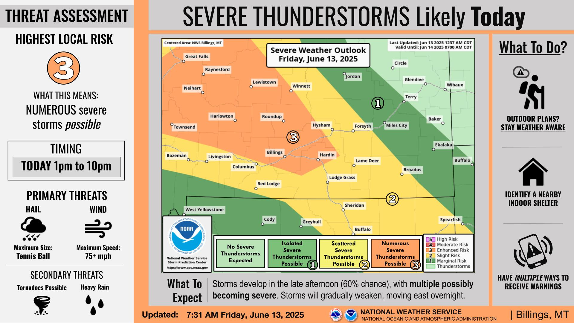
Showers and thunderstorms will develop this afternoon spreading east through the evening. Some thunderstorms are expected to become severe with very large hail, strong winds, heavy rainfall, and isolated tornado development
KEY POINTS
Numerous Severe Storms Possible Friday
Scattered Severe Storms Possible Saturday and Sunday
Daily Showers and Storms Through Midweek
Mountain Snowmelt Will Continue


DETAILS
Numerous Severe Storms Possible Friday
Wind gusts could be as high as 75+ mph
Hail up to tennis ball sized possible in the strongest storms
2-5% chance of tornadoes
Heavy rain remains possible
Scattered Severe Storms Possible Saturday and Sunday
Increased from Isolated
10% chance of hail greater than 2 inches
2% chance of tornadoes

Daily Showers and Storms Through Midweek
Mountain Snowmelt Will Continue
Minor rises are forecast on area creeks and rivers.
FOR MORE INFORMATION
For the latest forecast updates, visit weather.gov/billings.