


Turning Cold with Lower Elevation Snow This Week
Sunday evening National Weather Service update

There is a dramatic change to wintry conditions coming this week. Confidence in a period of cold and snowy weather has increased over the past couple of days.

KEY POINTS
Canadian cold front arrives Tuesday afternoon; snow begins in the west Tuesday night
Much colder with accumulating lower elevation snow Wednesday & Thursday
Below normal temperatures linger into next weekend
DETAILS
Snowfall
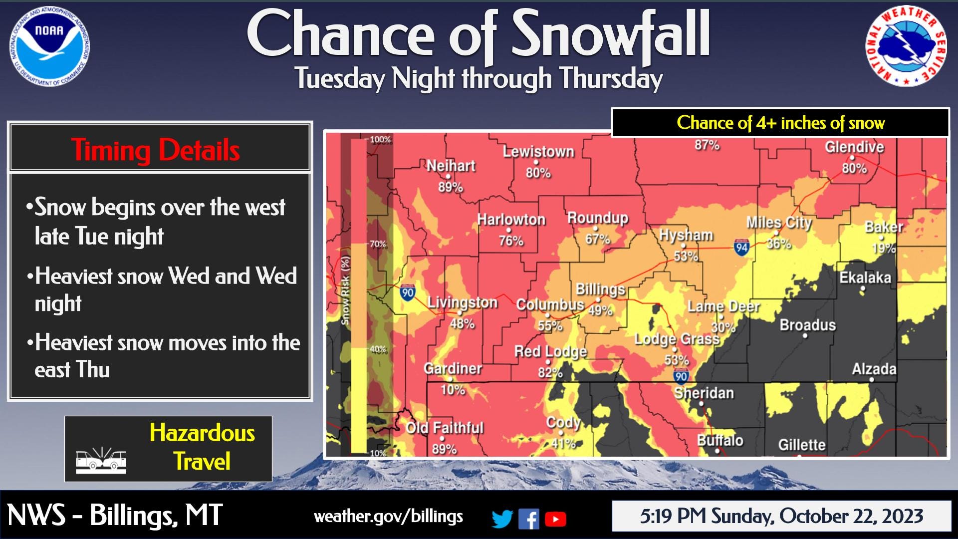
Two waves of accumulating snow expected, the first Tuesday night and Wednesday, the second late Wednesday night through Thursday
Probability of at least 4" of snow is high in the west (70-90%) and moderate in the east (30-50%)
Uncertainty remains so please monitor the forecast
Temperatures
Temperatures fall below freezing across the region Wednesday, and very cold air lingers into the weekend
Highs in the 20s and lows in the single digits and teens will be common through the second half of the week
Impacts
Travel will be affected by icy and slick roads
Trees with leaves may suffer damage
Sprinkler systems with water in lines may freeze up
Now is a good time to make sure your vehicles are stocked with winter survival supplies.