


Thursday Brings Heavy Snow for Some
Up to 17 inches at Red Lodge Mountain, but only about 2.5 inches in Bridger

By Denise Rivette
The Billings offfice of the National Weather Service provides invaluable information for residents of the area. Their data and analysis allow us all to plan for incoming weather events, like the one heading our way tomorrow, and to minimize their effects on our lives. Their graphics and text distill that information so that it is easy to understand and use.
This is an excellent time to remember and be thankful for the people of the National Weather Service, public servants devoted to their work and our safety. The National Weather Service (NWS) is part of the National Oceanic and Atmospheric Administration (NOAA) branch of the Department of Commerce. The critical nature of the NWS mission is the reason it is under the direction of the Department of Commerce which is responsible for gathering data for business and governmental decision making.
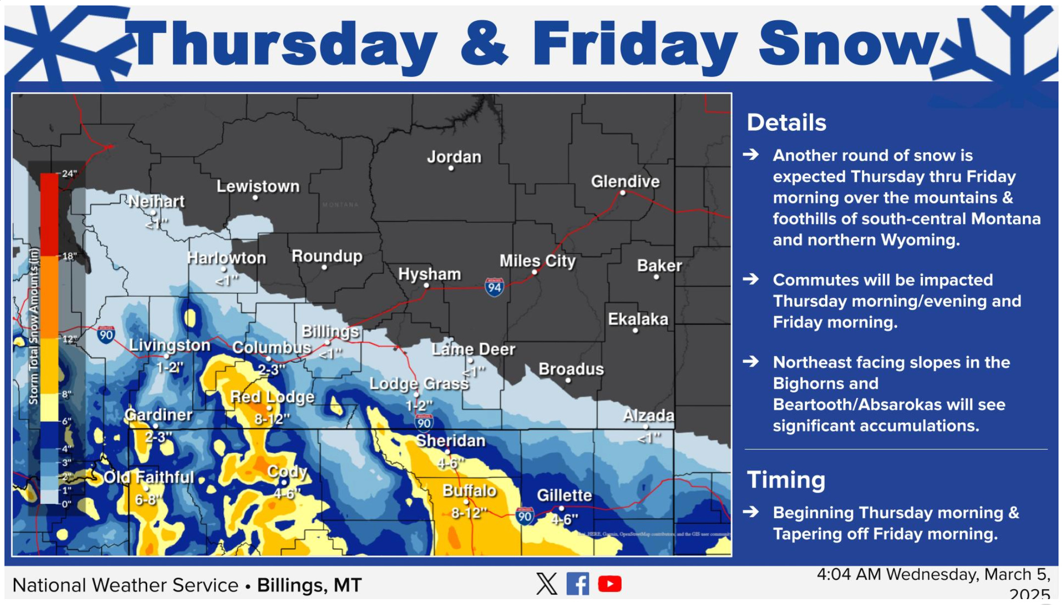
Another round of snow is forecast for areas south and southwest of Billings Thursday into Friday.
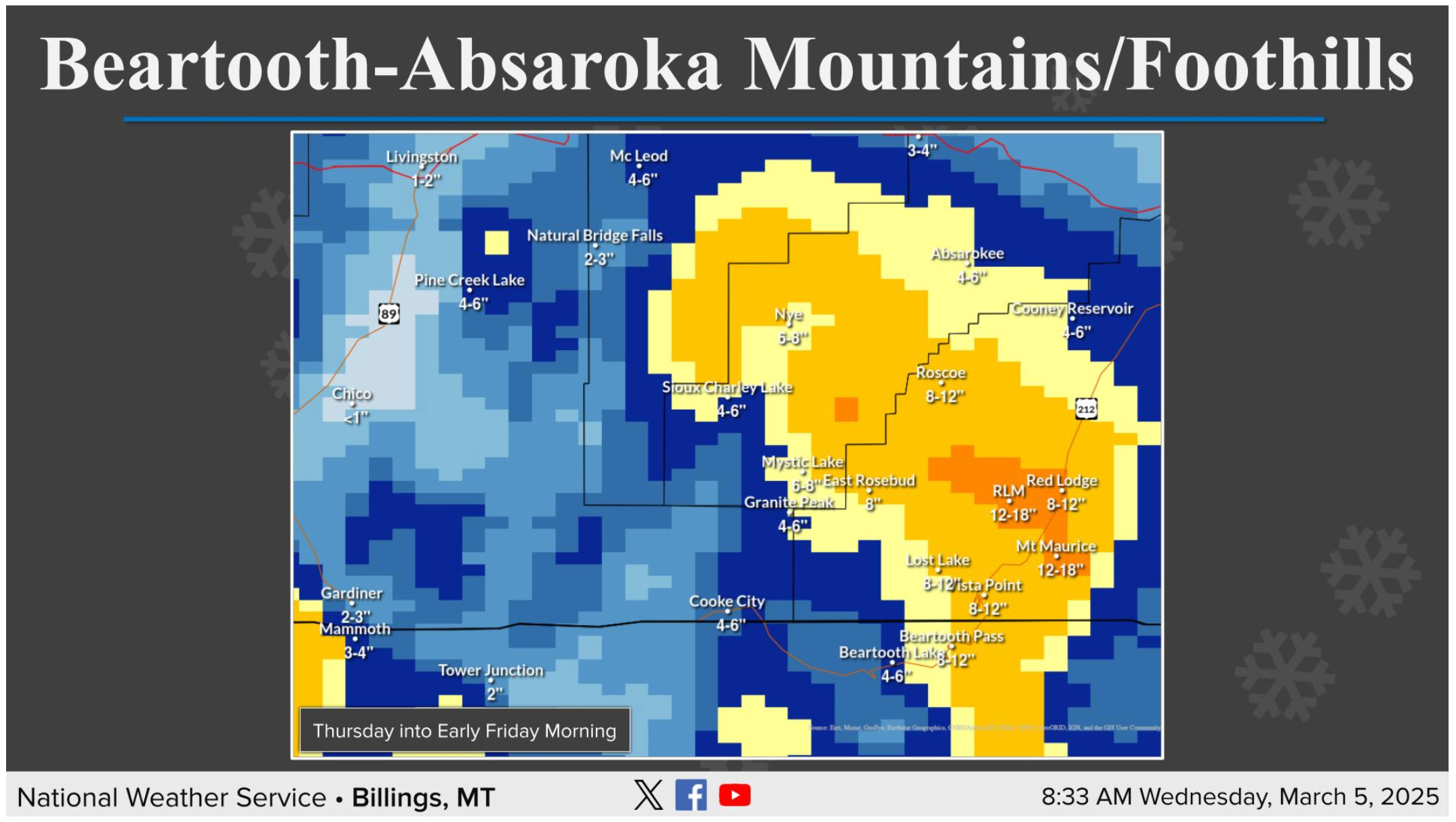
The above graphic shows the snow forecast for the Beartooth-Absaroka mountains and foothills. With northeasterly winds in place, the highest snow totals will exist on northeast facing slopes around Red Lodge to Nye.

The above graphic shows the snow forecast for the Bighorn and Pryor mountains and foothills. With easterly winds in place, the highest snow totals will exist on east facing slopes around Story. Heavy snow is expected to extend out to Sheridan as well.

