Temperatures to Drop 30-40 Degrees Monday Night Into Tuesday With Snow Accumulations
Prepare yourselves and animals, expect slick roads Tuesday

By Denise Rivette
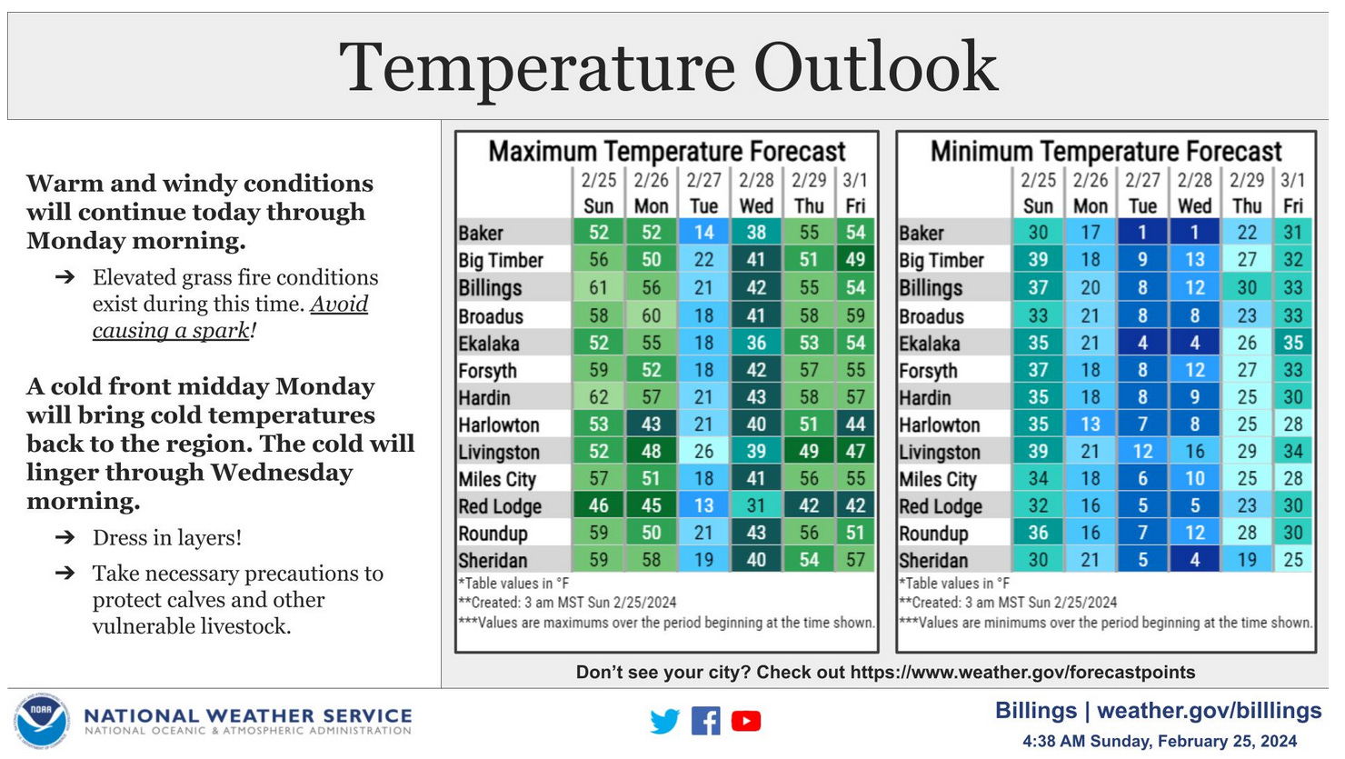
The Billings office of the National Weather Service predicts our warm and windy weather will transition briefly to cold and snowy by Monday evening. Tuesday will be the coldest day of the week before a warming trend is expected to move back in on Wednesday.
Slick and snow packed roads may impact the Monday evening and Tuesday morning commutes.
The mountains and foothills have the best chance to see the most impactful snow with this system.
Snow accumulations are predicted as follows:
Bearcreek - approximately 7 inches
Bridger - approximately 3 inches
East Rosebud Lake - approximately 11 inches
Fromberg - approximately 3 inches
Joliet - approximately 4 inches
Red Lodge Mountain - approximately 11 inches
Red Lodge City - approximately 9 inches
Roberts - approximately 6 inches
Roscoe - approximately 9 inches
Warren - approximately 2 inches