


Snow Starting Saturday and Potentially Impacting the Monday Morning Commute

By Denise Rivette
The Billings Office of the National Weather Service expects a weather system will bring precipitation to the region Saturday afternoon into Monday. There is a moderate chance that the Monday morning commute will be impacted in our area. Make sure to stay up to date with the latest forecast through the weekend.
KEY POINTS
Rain Transitioning to Snow over the Lower Elevations Saturday into Monday
Potential Winter Impacts to the Monday Morning Commute
Periods of Moderate to Heavy Snow in the Beartooth/Absaroka Mountains
For the Latest Advisory, Watch, and Warning Products, visit weather.gov/billings


DETAILS
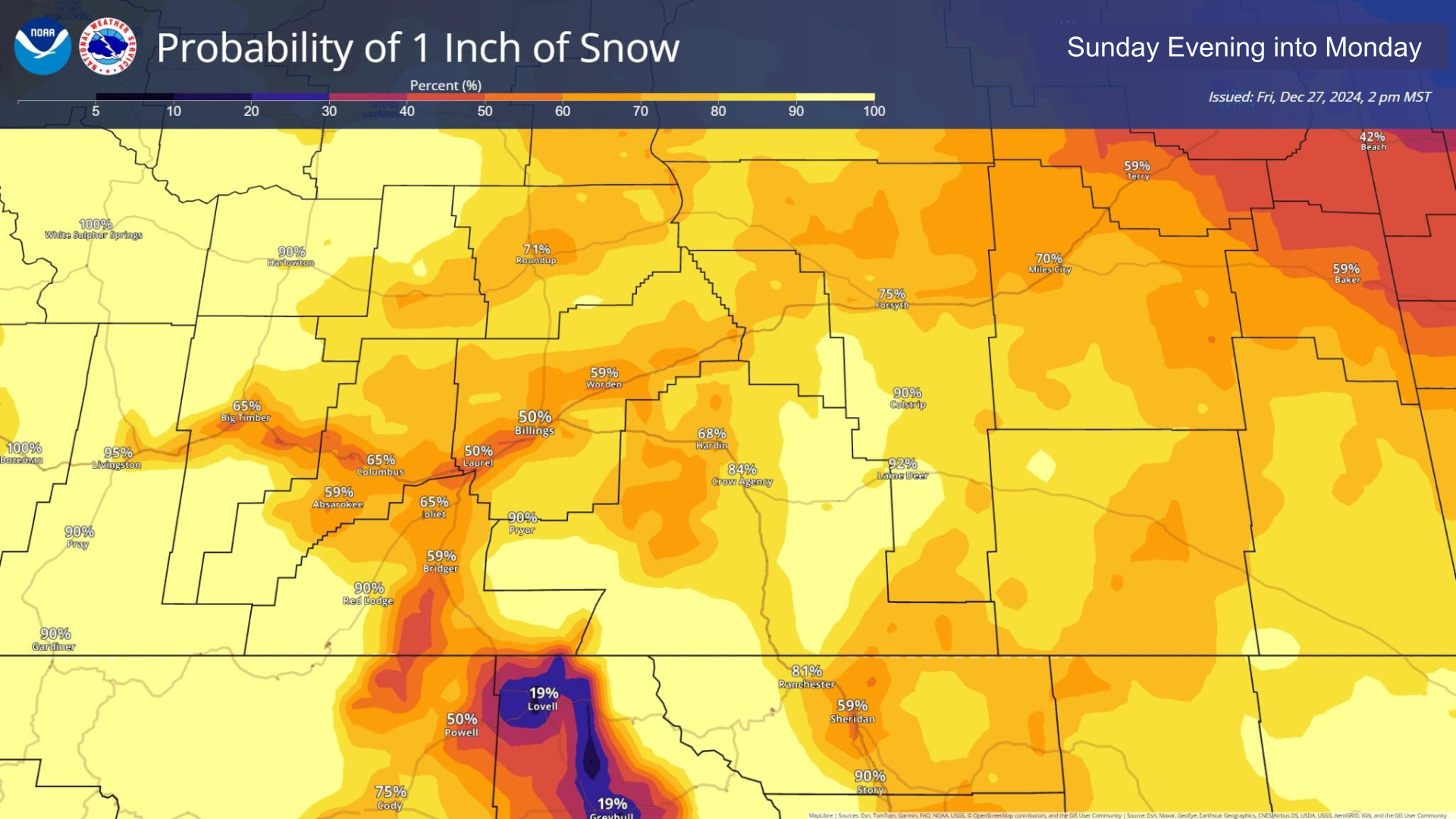
Rain Transitioning to Snow over the Lower Elevations Sunday into Monday
The chance of precipitation increases from west to east through the day Sunday. The best chance of precipitation is Sunday evening into Monday morning across the area. The chance of precipitation decreases through the afternoon and evening Monday.
Precipitation is forecast to begin as rain over the lower elevations before transitioning to snow Sunday night into early Monday morning.
Uncertainty remains on the timing of the transition from rain to snow.
See attached graphic for the latest snowfall probabilities.
Potential Winter Impacts to the Monday Morning Commute
Minor impacts from slick roads with areas of reduced visibility in snow are possible (moderate chance).
Periods of Moderate to Heavy Snow in the Beartooth/Absaroka Mountains
Heaviest Sunday morning into Monday morning.
10 to 15 inches possible, mainly on west facing slopes.
While snow is still expected in the Pryor and Bighorn Mountains, accumulations will be less.

