


Rain Turning to Snow Monday Through Thursday - Below Freezing Low Temperatures
Protect animals and plants, slow down walking and driving

By Denise Rivette
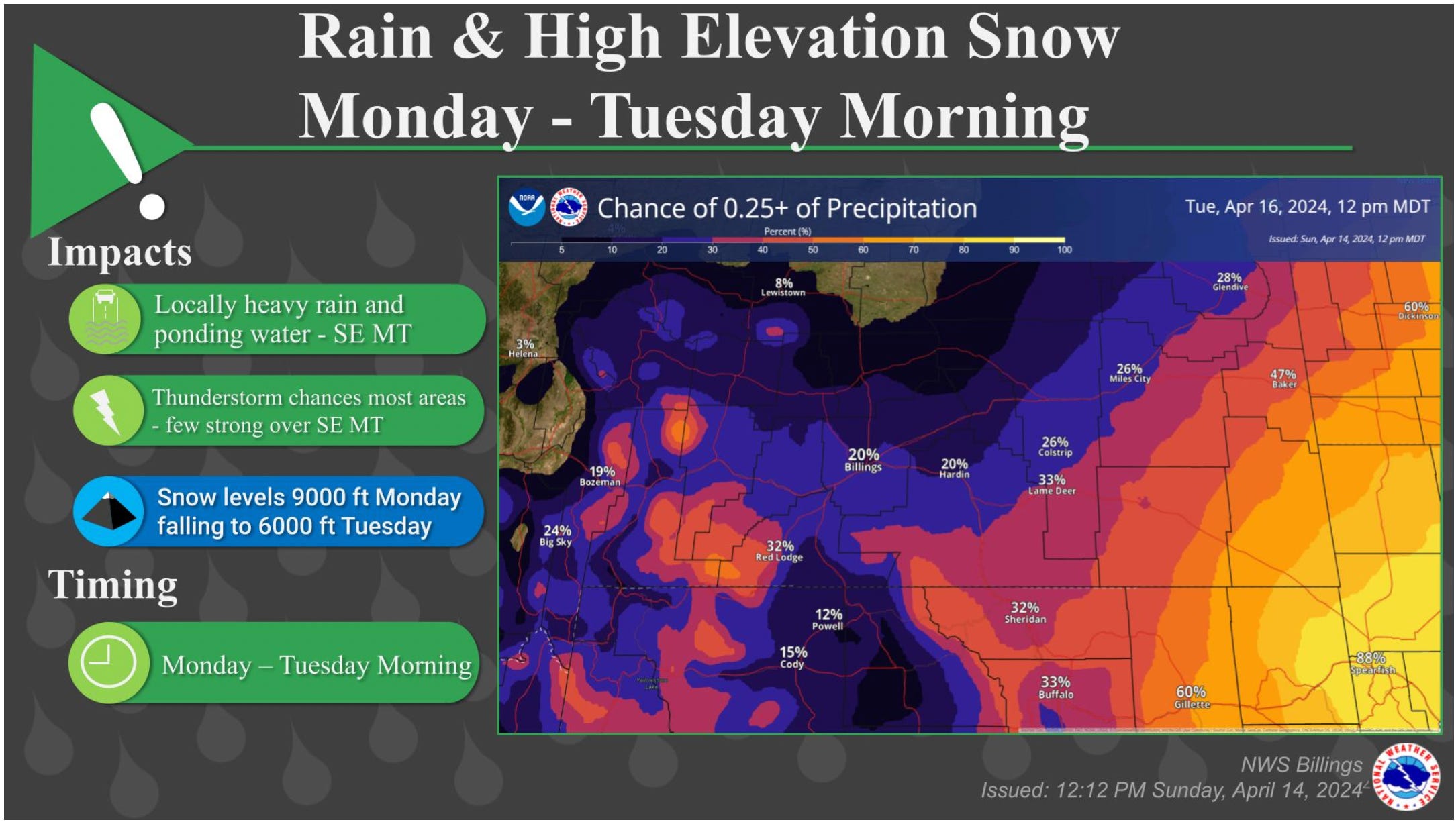
The Billings office of the National Weather Service reports that shower and thunderstorm chances will increase Monday into Monday night, gradually decreasing into Tuesday as a weather system moves through the region. Some of the thunderstorms could be strong over southeast Montana. Greatest precipitation chances will be found over southeast Montana, where locally heavy rain and ponding is possible. Snow is possible for the higher elevations as well.
The storm system will generate a good chance of rain (or wet snow) for the lower elevations, and accumulating snow for the mountains. The mountains and foothills have a greater than 70% chance of seeing 6 inches or more of snow Tuesday night through Thursday. The rainfall (or water equivalent of the wet snow) will have a good chance of accumulating a quarter inch or more.

DETAILS
Thunderstorms
Thunderstorms could be strong Monday afternoon and evening over southeast Montana.
Hail and heavy rainfall will be the primary threats.
Weaker thunderstorms are also expected from Billings west Monday afternoon and evening.
Brief heavy rain and small hail can not be ruled out with these storms.
Accumulating Wet Snow
Wet snow develops in the mountains and foothills Tuesday night and continues into Thursday.
Mountains should see 10-18 inches of accumulating snow.
Mountains have a 80% chance of picking up 10+ inches of snow, with a 60% chance of 12 inches.
The Beartooth and Red Lodge Foothills could see 6-12 inches of accumulating snow.
Red Lodge has a 80% chance of picking up 6 inches or more of wet snow.
Lower elevations west of Billings could pick up 2-5 inches of snow, if cold air settles in well enough.
Billings could even see an inch or more of wet snow, depending on the temperatures.
Confidence and Uncertainty
Confidence is increasing on accumulating wet snow developing over the mountains and foothills.
Confidence is also increasing on the timing of the event.
Uncertainty exists on the exact snow amounts for the mountains and foothills.
Uncertainty exists for the lower elevations (west of Billings) as cold air could allow these locations to accumulate 2-5 inches of wet snow.
Carbon County Snow Accumulations Tuesday Through Thursday are Currently Predicted as Follows:
Bearcreek: approximately 7 inches (Overnight low temperatures: Tuesday 29°, Wednesday 21°, Thursday 21°)
Bridger: approximately 3 inches (Overnight low temperatures: Tuesday 32°, Wednesday 24°, Thursday 23°)
East Rosebud Lake: approximately 12 inches (Overnight low temperatures: Tuesday 22°, Wednesday 14°, Thursday 13°)
Fromberg: approximately 3.5 inches (Overnight low temperatures: Tuesday 33°, Wednesday 24°, Thursday 25°)
Joliet: approximately 3.5 inches (Overnight low temperatures: Tuesday 32°, Wednesday 23°, Thursday 24°)
Red Lodge Airport: approximately 10 inches (Overnight low temperatures: Tuesday 27°, Wednesday 19°, Thursday 18°)
Red Lodge City: approximately 10 inches (Overnight low temperatures: Tuesday 28°, Wednesday 19°, Thursday 18°)
Red Lodge Mountain: approximately 11 inches (Overnight low temperatures: Tuesday 27°, Wednesday 18°, Thursday 17°)
Roberts: approximately 5.5 inches (Overnight low temperatures: Tuesday 30°, Wednesday 21°, Thursday 21°)
Roscoe: approximately 9 inches (Overnight low temperatures: Tuesday 29°, Wednesday 19°, Thursday 19°)
Warren: approximately 2.5 inches (Overnight low temperatures: Tuesday 32°, Wednesday 24°, Thursday 23°)