Precipitation Returns Late Sunday

From the Billings office of the National Weather Service
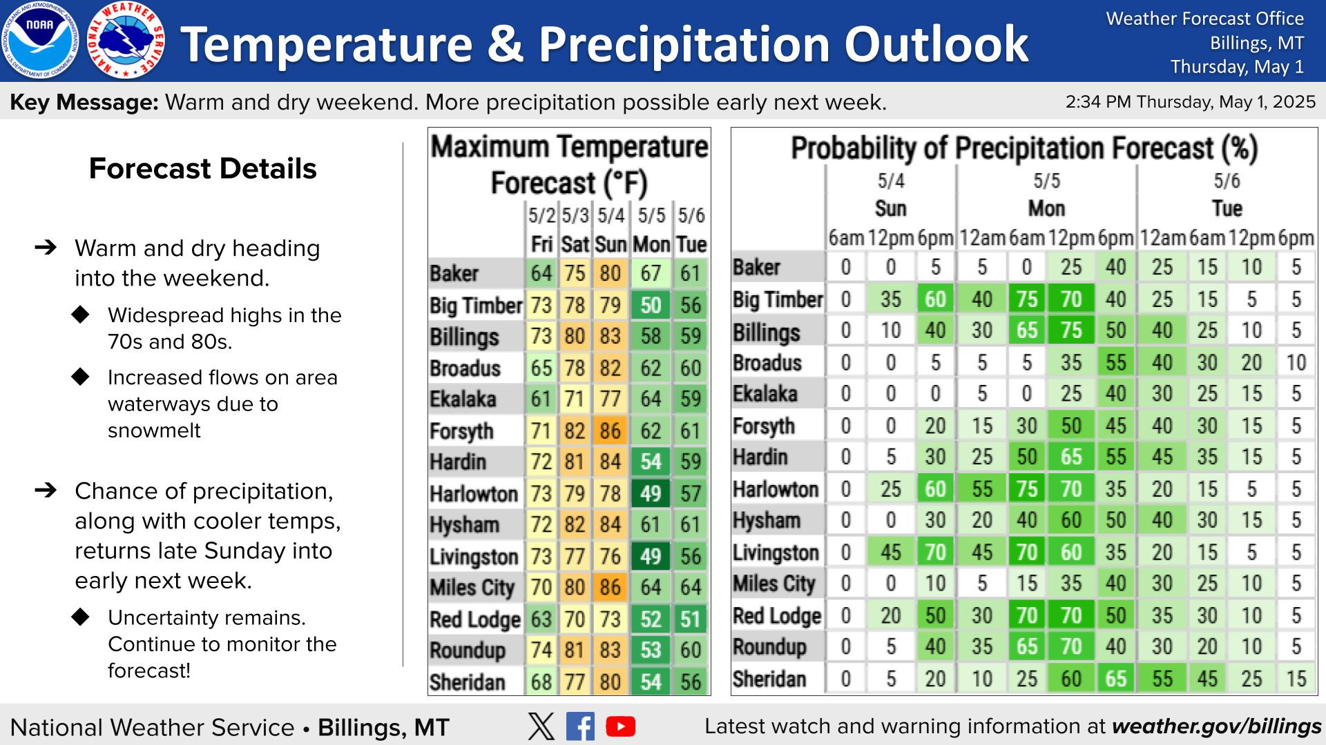
Good Morning! This weekend is looking warm and dry, but precipitation chances return for the start of the work week.
KEY POINTS
Warm & Dry Weekend
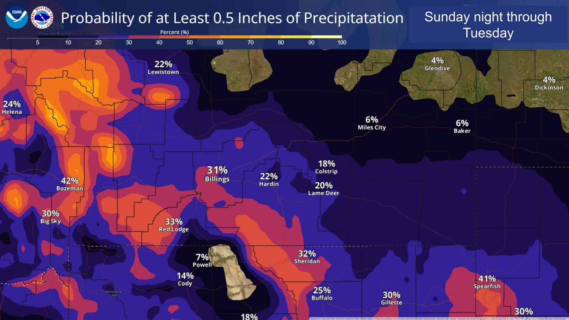
Precipitation Chances Return Late Sunday
Dry Weather Returns Late Next Week

DETAILS
Warm & Dry Weekend
High temps above average Friday through Sunday.
All locations below 4500' could see highs ≥80°F Sat & Sun
Mid-Elevation snowmelt will increase flows on waterways.
Cooler & Wet Late Sun-Tues
What we know:
The next storm system moves into the west Sunday afternoon/evening.
Widespread cooler temps and precipitation is expected.
This system will be warmer than last week with higher snow levels.
What we don't know:
While the path of the system is slowly becoming more certain, what remains up in the air is how far north the impactful precipitation will reach.
Exact snow levels and precipitation totals. Current forecast has snow levels dropping from 10,000' Sun to 6,000' Mon and the chance for 0.5" rain SW of Billings is 30-60%.
Dry Weather Returns Late Week
A building ridge will bring dry weather with highs in the mid to upper 70s to end the week.