

Minor Flooding Threat Continues; Be Prepared; Rain Showers Will Move into the Region Tuesday Night

By Denise Rivette
Widespread precipitation in excess of 1 inch has fallen along the Beartooth and Bighorn mountain foothills. This has led to some localized flooding. Another round of precipitation is expected Tuesday night which could add to flooding concerns.
The major flood threat has currently decreased, but there are still areas that may experience possible sudden severe impacts such as fire scars and roadways. With the expected rise in stream levels, officials are continuing to monitor gauges. It is expected they will level out soon.
BE PREPARED
Now is the time to get prepared. If you live near floodprone or burn scar areas, get your go-bags ready and have a plan. Let your friends and loved ones know your plan. Check on your neighbors and make sure they have a plan and are prepared.
It is the homeowner’s responsibility to protect their private property. Government entities are responsible for saving lives and protecting public property. Make sure you have sandbags (local retailers and e-tailers have them in stock) if you may need them. Local governments may have extra sandbags, but they are only available after an emergency has been declared and their supply is limited.
And if you haven’t already, sign up for CodeRED HERE.
Please report any flooding to Carbon County Sheriff’s Dispatch at (406) 446-1234. If it is an emergency, call 911.
Flooding or Riparian Area Functioning Normally?
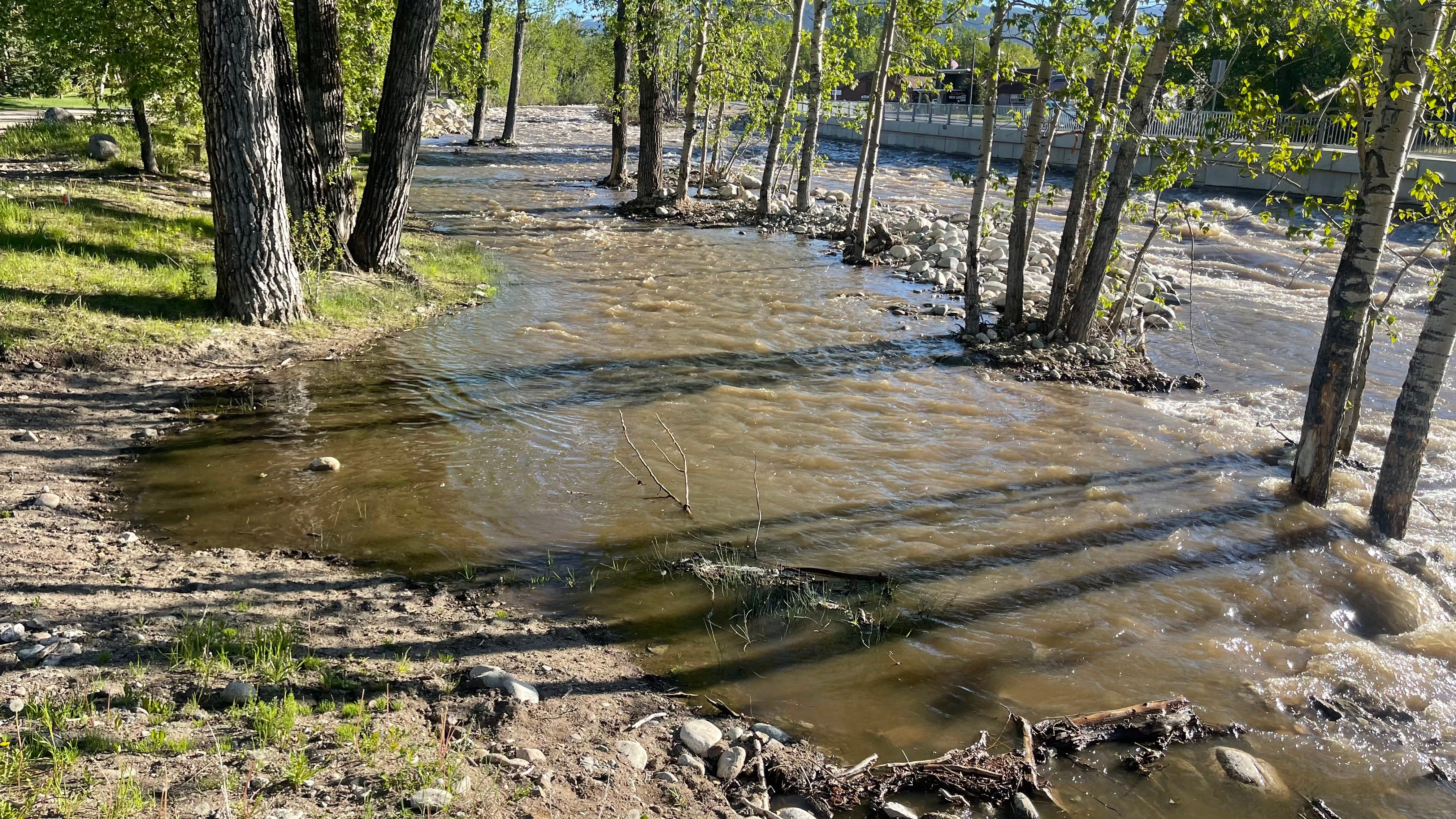
The above is a photo of a riparian zone functioning normally, not flooding dangerously in Red Lodge. Flooding is when water is where it is unexpected and likely to cause problems, such as near roadways. If you are in doubt, call it in at (406) 446-1234, the business line at Carbon County Sheriff’s Dispatch. If it looks like it could be an emergency, call 911.
You can keep an eye on local water levels at the links below:
Clarks Fork of the Yellowstone at Edgar
Rock Creek (South Central MT) near Red Lodge MT
West Fork Rock Creek near Red Lodge
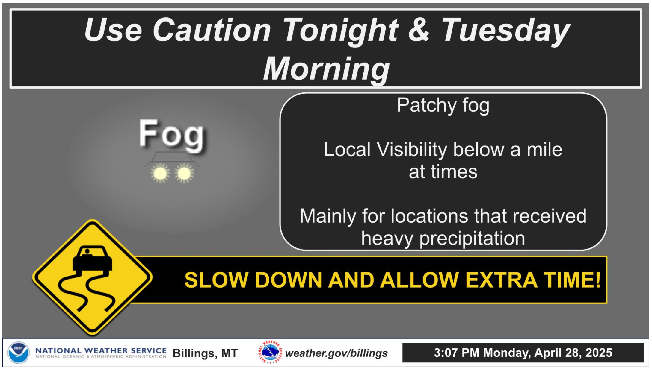
Recent heavy rainfall will lead to fog potential across southeast Montana tonight into Tuesday morning. Reductions in visibility and difficult travel are possible.
Rain showers will move into the region Tuesday night bringing generally light precipitation to the region. Even light precipitation over saturated soils has the potential to cause minor flooding concerns along the foothills. Snow is expected over the mountains.