


Impactful Spring Storm Imminent - Heavy Snowfall and Rain Possible

From the Billings office of the National Weather Service

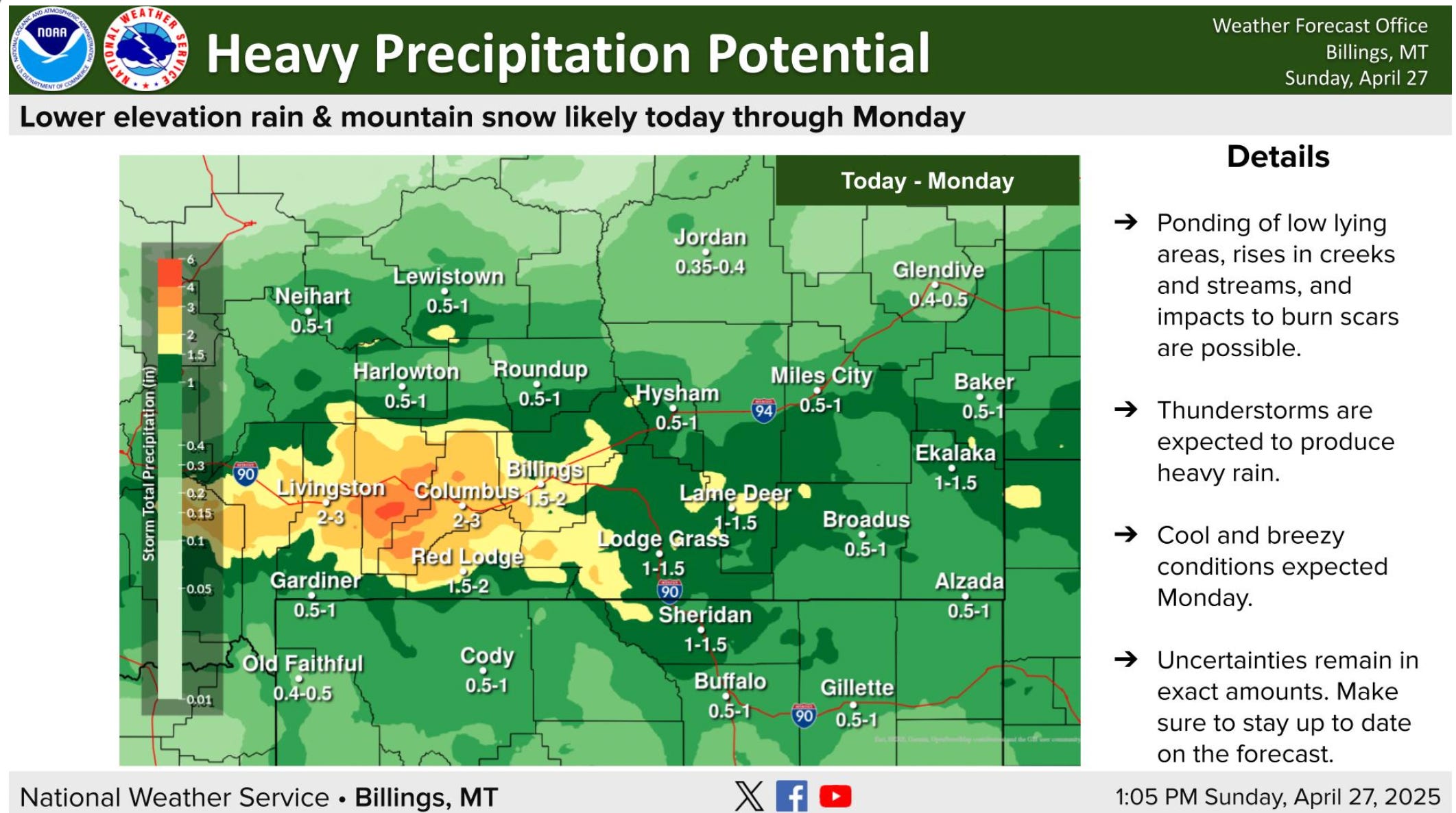
An impactful storm will move through our area this afternoon through Monday.
KEY POINTS
Severe weather possible this afternoon and evening
Heavy precipitation leading to flooding concerns
Heavy mountain snowfall expected
CHANGES FROM PREVIOUS BRIEFING
• Severe weather possible today
• Snow levels lower than previous forecast

DETAILS
Severe weather possible this afternoon and evening
Strong to severe storms are possible from the Beartooth Foothills eastward this afternoon and evening.
Severe storms are most likely for Rosebud County and locations east towards the Dakotas.
Primary hazards will be strong winds and large hail.
Every thunderstorm will be capable of producing heavy downpours and cloud-to-ground lightning.
Heavy precipitation leading to flooding concerns
The foothills of the Absaroka/Beartooth mountains could see a total of 2-4" of rain over 36hours.
This could cause some minor lowland flooding in addition to filling up creeks and streams.
For additional impacts and details: https://forecast.weather.gov/product.php?site=byz&issuedby=BYZ&product=FFA
The entire region is expected to see at least 0.5" with higher totals the farther south and west you go.
Heavy mountain snowfall expected
Snow levels will rapidly drop overnight tonight allowing for all the mountains to see heavy accumulating snow.
Widespread totals over 1 foot are likely with locations over 9,000' seeing 2-3 feet.
With snow levels now forecast to be around 5,000' Monday morning, the Beartooth and Red Lodge Foothills could see 2-6" Monday.