


Heavy Rain with Possible Flooding Concerns Sunday and Monday
Another spring storm is taking shape for Sunday into Monday. Stay up to date with the latest forecast if you have travel or outdoor plans during this time.

From the Billings office of the National Weather Service (NWS)
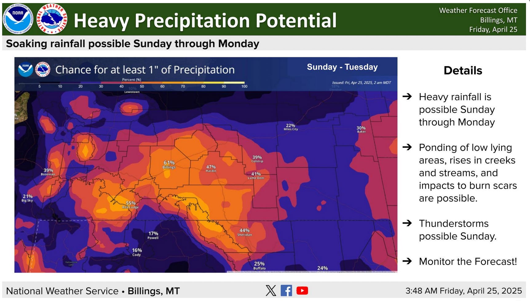
NWS has provided an update to the potential flooding concerns associated with moderate to heavy rainfall Sunday evening through Monday. The greatest concern will be the impacts from flash flooding over burn scars as well as localized flooding and stream rises.
KEY POINTS
Flooding Concerns
Heavy Rain
Mountain Snow

DETAILS
Moderate to heavy rainfall is expected to begin late Sunday afternoon, ending Monday night
A cold front expected to move through Sunday evening will bring a slight chance of thunderstorms to the region with additional precipitation to follow
With above average atmospheric moisture, any thunderstorm has the potential to produce heavy rainfall and localized flooding
Much of south-central Montana has a 40-60% chance of getting at least 1" of water with this system
Flooding concerns for new burn scars
With several new burn scars across the region, there is uncertainty as to how these will respond to excess precipitation
Burn scars take less time and moisture to produce flash flooding given their waxy surface and lack of vegetation
Given snow levels will begin around 9,000 ft late Sunday afternoon, there is potential for thunderstorms to create a rain on snow event
Snow levels will drop to around 6-7,000 ft into Sunday evening. Any burn scar areas under these elevations would remain at risk for flash flooding
Mountain Snow
There is a 60-90% chance for at least a foot of snow in the Beartooth/Absarokas with a 40-60% chance for the Pryors/Bighorns
A 60% chance of at least 18 inches exists for the highest peaks of the Beartooth/Absarokas
For the latest forecast updates, visit weather.gov/billings.