


Forecast Update: One More Inch of Snow For the Mountain, Four Inches Less for Joliet
Travel will still be impacted in Carbon County

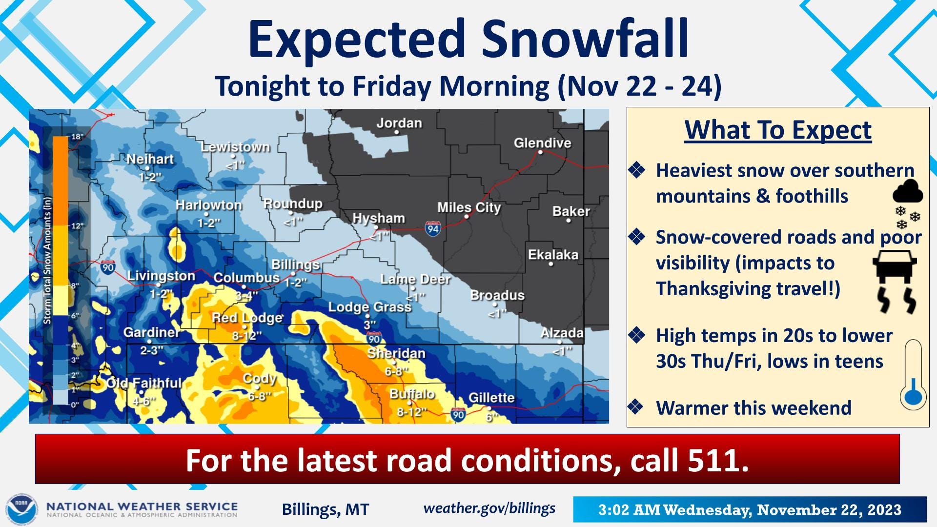
Good Morning! The National Weather Service in Billings has provided the latest winter storm information. Over the past 24 hours the storm system that was to bring heavy snow to our area has trended southward, diminishing the chance for heavy snow across many areas. At this time the prospects for more than 6 inches of snow from tonight through Friday morning are confined to north and east facing mountains and foothills. Less snow results in improved travel forecasts, especially heading north and east. Travel southward into Wyoming and Colorado will still experience areas of heavy snow Thursday and Friday. Carbon County roads will be impacted, plan accordingly.
It is now forecasted for Red Lodge Mountain to receive an inch more than earlier predicted for 13” of fresh snow for opening day on Friday. Around the county, Roscoe can expect around 9” (down an inch), East Rosebud Lake 10” (up 3”), Roberts 7” (down 1”), Joliet 3” (down 4 inches), Edgar, Fromberg and Bridger 3” (down 2”), Belfry 3.5” (down 0.5”) and the forecast for Bearcreek remains the same at 8”.
For a couple of days starting tomorrow, the temperatures will range in the high 20s and low 30s with nighttime temperatures dropping into the teens. Prepare yourselves and your animals for the change.
Have a happy, warm and safe Thanksgiving!