Damaging Winds Possible Today
Areas above Red Lodge, around Luther and Roscoe, and along US-308 through Bearcreek are at the greatest risk
Information from the Billings office of the National Weather Service
The wind forecast, and the potential for damaging winds over the immediate foothills of the Beartooth and Bighorn mountains, has increased. With that said, uncertainty still remains. Find the latest updates at weather.gov/billings.
Beartooth Mountains & Foothills
Strong Winds
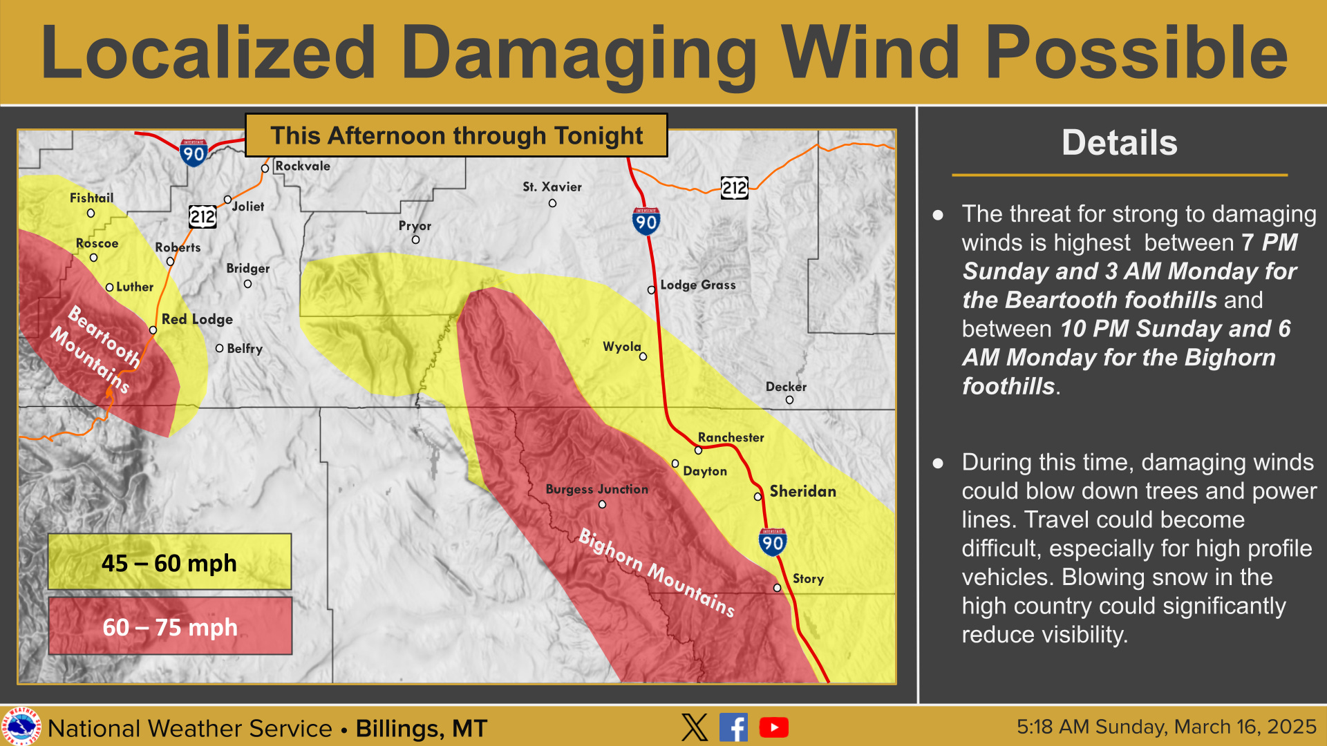
NWS is reporting with moderate confidence that strong winds expected in the mountains. Over the foothills, strong to potentially damaging winds are possible. Wind gusts of 60 to 75 mph are forecast in the Beartooth Mountains. Over the foothills, wind gusts of 45 to 60 mph are possible, with locally higher gusts possible in the higher terrain of the foothills. Areas above Red Lodge, around Luther and Roscoe, and along US-308 through Bearcreek are at the greatest risk for damaging winds. Should the damaging winds develop, trees and power lines could be blown down. Travel could also become very difficult, especially for high profile vehicles.
The most likely time frame for strong, potentially damaging winds is between 7:00 p.m. this evening and 3:00 a.m. Monday. Before this, breezy conditions are forecast through the day.
Snow & Blowing Snow
In addition, NWS reports with high confidence that heavy snow and whiteout conditions are expected in the Beartooth-Absaroka Mountains. This will make recreation in the high country very difficult to life-threatening. Expect a significant increase in avalanche danger during this time. Heavy winds and whiteout conditions are expected today into tonight.
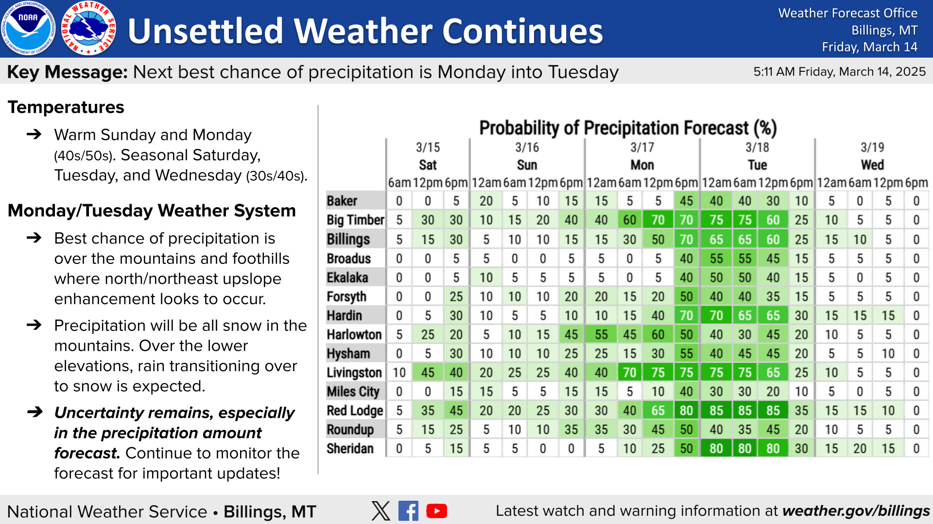
Moderate to heavy snow is expected to continue Monday into mid-day Tuesday. During this time, 1 to 2 feet of snow is forecast in the Beartooth-Absaroka Mountains, greatest on west facing aspects.
Bighorn Mountains & Foothills
Strong Winds:
NWS reports with moderate confidence that strong winds are expected in the mountains. Wind gusts of 60 to 75 mph are possible in the Bighorn Mountains. Over the foothills, wind gusts of 45 to 60 mph are possible, with locally higher gusts possible in the higher terrain of the foothills. Areas around Story, Big Horn, and Dayton are at the greatest risk for damaging winds. Dangerous crosswinds may also extend out over Interstate 90 through Sheridan County, Wyoming during this time. Over the foothills, strong to potentially damaging winds are possible. Should the damaging winds develop, trees and power lines could be blown down. Travel could also become very difficult, especially for high profile vehicles.
The most likely time frame for strong, potentially damaging winds is between 10:00 p.m. this evening and 6:00 a.m. Monday. Before this, breezy conditions are forecast through the day.


