Chilly with Rain to Wet Snow Late Today to Friday - Flooding NOT Expected
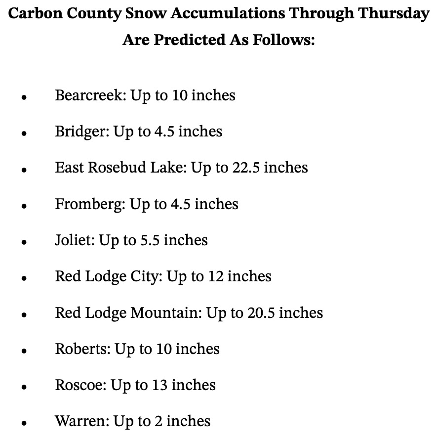
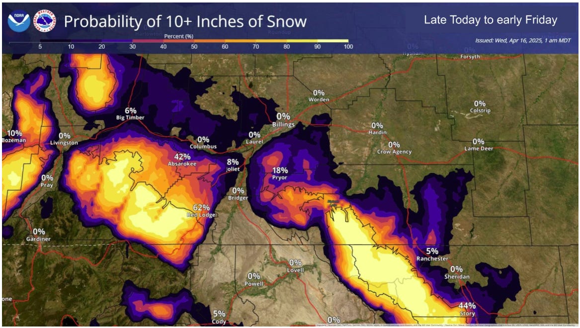
East Rosebud Lake and Red Lodge Mountain expecting over 20 inches

By Denise Rivette
The Billings office of the National Weather Service has issued an update on the approaching cool and wet weather system that will impact our region later today to Friday. See below for details.
KEY POINTS
Heavy snow for mountains and foothills tonight to Friday
Lower elevations see rain change to wet snow tonight; some snow accumulation expected
Impacts to travel, outdoor recreation and young livestock

DETAILS
Today
Cold front arrives; rapid cooling by evening
Rain develops this afternoon and evening, then changes to wet snow tonight
Tonight to early Friday
Heavy snow for mountains and foothills (1-2 feet on northeast aspects including the mountains near Red Lodge)
Some wet/slushy snow accumulation at lower elevations
Lower elevation snow accumulation will be elevation dependent, with the higher hills seeing the most snowfall
Wintry Impacts
Difficult travel due to snow and poor visibility, especially close to the foothills
Outdoor activities may need to be altered or rescheduled
Cool and wet weather, with 25 to 35 mph wind gusts, will be hazardous for young livestock
This weekend into next week
Dry Saturday, then more unsettled weather with mountain snow and lower elevation rain showers Sunday through Tuesday
Depending on how much snow accumulates, melting snow along the foothills may cause rises on some rivers and streams (flooding NOT expected)