


Be Alert: Snowmelt and Blowing Snow Expected to Affect Area
If you haven't already, now is the time to move equipment and livestock out of low lying areas and away from waterways

Information compiled from the Billings office of the National Weather Service and Carbon County Disaster and Emergency Services

An extended period of mountain snowfall can be expected for the western mountains through Tuesday night. Persistent light to moderate snowfall will bring totals in excess of a foot for some locations in the mountains. Strong winds will create blowing snow.
Little to no snow accumulation is expected (less than an inch in Red Lodge and less than 2 inches at Red Lodge Mountain), but rain and warm temperatures will contribute to significant snowmelt runoff over frozen ground. The threat of localized flooding from this process will increase into next week. Ice jams and associated flooding are also a possibility.
If you have interests along waterways and in flood prone areas, be prepared for the potential of rising waters. This includes moving equipment and livestock out of low lying areas and away from waterways, moving heavy accumulations of snow away from structures and clearing any outside drains of snow and ice.
The county will continue to monitor the roads and rivers. The National Weather Service in Billings and Carbon Alert use Facebook pages for updates. Call the Carbon County Sheriff's Office non-emergency number, 406-446-1234, to report water over the road or ice jams.
Dial 911 for an emergency.
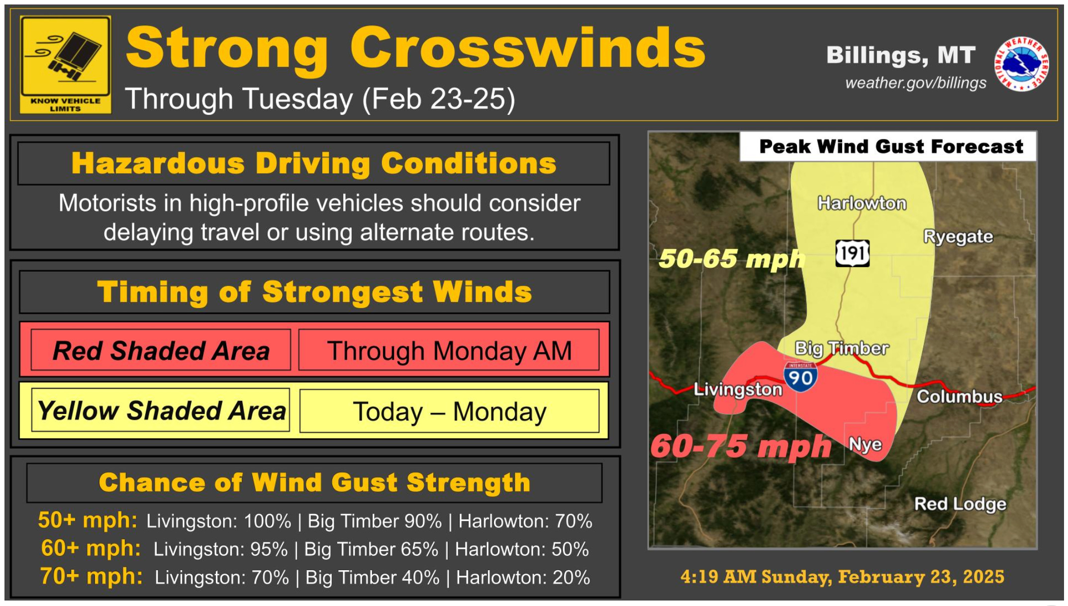
Strong southwest to west winds will continue along the western foothills in south central Montana through Tuesday. Travelers, especially those in high-profile vehicles and towing trailers, should expect to encounter hazardous crosswinds on portions of I-90 and US-191.
Please check forecasts and road reports before traveling. Call 511 or go to 511mt.net for Montana road conditions.