


ALERT: Dangerous Conditions for Young Livestock and Pets Tonight Through Wednesday
Update on the cold weather expected to move into the region over the next few days and the weather for the week ahead.

By Denise Rivette

The Billings office of the National Weather Service provided an update on the cold weather expected to move into the region over the next few days and the weather for the week ahead.
KEY POINTS
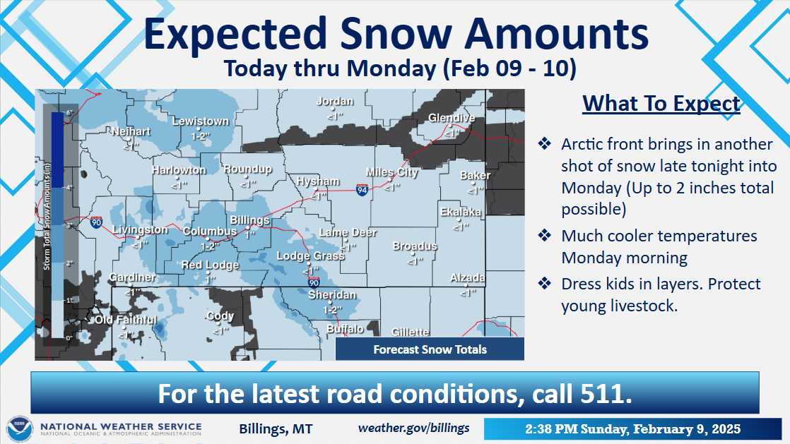
Arctic cold front arrives late tonight bringing light snow to portions of the area and much colder temperatures on Monday
Very cold temperatures and wind chill values expected Monday night through Wednesday
Temperatures moderate some Thursday, with another period of accumulating snow and cold possible late in the week

DETAILS
Arctic cold front arrives late tonight bringing light snow and much colder temperatures for Monday
Snowfall amounts from a trace to 2 inches on Monday, greatest along and south of I-90 (including Billings)
High temperatures on Monday in the single digits below and above zero, coldest over northern areas
Very cold temperatures and wind chill values Monday night through Wednesday
High temperatures in the single digits below and above zero Tuesday; single digits above zero to around 10 degrees F Wednesday
Low temperatures -30 to -15 degrees F Monday night/Tuesday morning; -20 to -10 degrees F Tuesday night/Wednesday morning
Moderate to high chances of temperatures of -20 degrees F or lower for areas north and east of a Harlowton to Billings to Broadus line Tuesday morning (greater than 50% chance)
Wind chill values of -45 to -25 F Monday night/Tuesday morning; -35 to -15 F Tuesday night/Wednesday morning

Cold Weather Preparedness
Don't leave kids alone at the bus stop
Dress in layers and limit time outdoors
Protect young livestock
Moderating temperatures Thursday, with additional snow and cold possible late in the week
Temperatures moderate some on Thursday with highs in the teens and 20s °F forecast
Colder conditions are possible Friday into the weekend with a period of accumulating snow
Uncertainty exists, continue to monitor the forecast through the week